New Map of Antarctica Brings Frozen Landscape Into Focus

El pasado mes la NASA publicó el mapa mas detallado del continente helado posible con la tecnología actual. Segun sus palabras:
The map, with a resolution 10 times greater than before, shows features half the size of a basketball court clearly, and is not pure white. It captures the textures and color variations of mountains, valleys and ice rivers and is available to researchers and the public online.
Realmente es increíble la resolución y os animo todos a disfrutar un rato de la cartografía que se ofrece en la pagina.
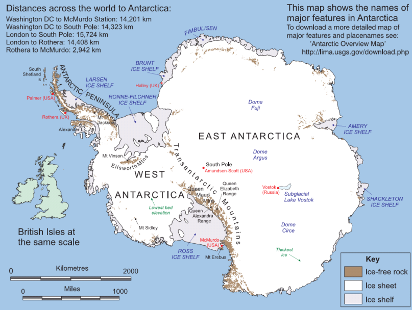 LIMA, así lo llaman (Landsat Image Mosaic of Antarctica) al sitio web donde se encuentra la información, así como póster descargable en formato PDF.
La pagina esta diseñada con motivo del Año Polar Internacional
 LIMA, así lo llaman (Landsat Image Mosaic of Antarctica) al sitio web donde se encuentra la información, así como póster descargable en formato PDF.
La pagina esta diseñada con motivo del Año Polar Internacional

Comentarios